Bicycling along the Military Trail Scenic Byway
View Bicycling along the Military Trail Scenic Byway in a larger map Click to refresh the map
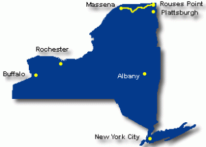
![]() Rouses Point, in the northeast corner of Clinton County in Northern New York State on Lake Champlain, is the eastern terminus of this 84-mile scenic byway that runs west along US Route 11 through Malone, and then northwest along NYS Route 37 to where it ends in Massena, near the St. Lawrence River. With few exceptions, the shoulders along the entire route offer peddlers enough space to travel safely.
Rouses Point, in the northeast corner of Clinton County in Northern New York State on Lake Champlain, is the eastern terminus of this 84-mile scenic byway that runs west along US Route 11 through Malone, and then northwest along NYS Route 37 to where it ends in Massena, near the St. Lawrence River. With few exceptions, the shoulders along the entire route offer peddlers enough space to travel safely.
Starting around Mother’s Day in May when the many lilacs are in bloom, and ending in late October, travelers along the Military Trail will find chicken dinners, barbecues, parades and community garage sales as opportunities to meet the colorful and interesting people who call this area home and make it such a great place to live and visit. The byway is also one of the few in New York State that travels through a first people’s reservation, the home of the St. Regis Mohawk Tribe and the surrounding Akwesasne community.
Gradual changes in elevation are one of the memorable features, especially for bicyclists. Boundless horizons and bountiful waters are the attraction of this byway. The easternmost part of the route runs along an escarpment that separates the northern foothills of the Adirondack Mountains and the littoral plain of the St. Lawrence River. There are several locales with long and inspiring vistas into Canada, which is never more than 15 miles away. The western section, starting in Malone, descends gradually down into the St. Lawrence littoral.
The proximity to Canada has been, and remains today, a rich intersection of culture. Many families living in the small villages and towns along the byway trace their ancestry to original settlers of the region who married Canadians of French or Irish descent.
The byway, broken into two parts with an approximate midpoint in Malone, offers a leisurely exploration today of what was the northernmost migration trail from New England for settlers seeking more land following the Revolutionary War against the British.
Known in the earliest days as the Chateaugay Trail, today’s byway traverses five major northern flow watersheds: the Great Chazy, the Chateaugay, the Salmon, the St. Regis, and the Raquette Rivers. Settlement patterns on the byway center around locales where these rivers and smaller streams begin the drop down into the St. Lawrence River plain; waterpower, navigable waterways, and the commercial interests that depended on them, coupled with excellent soils and abundant forests, were the primary engines of early economic growth. Agriculture remains today the dominant primary economic engine along the byway.
Bicyclists should explore the locally owned eateries to be found in every village along the route. At numerous farm stands, including those of Amish settlers in the area, stop to enjoy fresh in-season fruits, vegetables, and baked goods proudly offered by the owners.
Road Biking Opportunities
Family Bike Rides – Check out the Richards Landing Bike Trail and Whalen Park Trail that connect west of Massena at the Massena Country Club. Their 3 miles of paved pathway along the St. Lawrence River provide a scenic and family-friendly ride between the Massena Town Beach and Whalen Park – both attractive parks with beaches and facilities located on the St. Lawrence River.
- Or for some island biking, try Robert Moses State Park, just northeast of Massena. The Park, located partly on the mainland and partly on Barnhart Island, has a few quiet roads suitable for family biking. Visitors reach the park through a tunnel under the Eisenhower Lock. The park is spacious, home to a large variety of flora and fauna, and offers a multitude of recreational opportunities, including wooded campsites and cabins, a marina and boat launch, picnic areas, a swimming beach, and a year-round nature center. The park’s nature, hiking, and cross-country ski trails wind through fields, forests and wetlands, with overlooks showcasing spectacular views.
Moderate Ride – The William H. Miner Story is a 35-mile loop starting in Chazy, just north of Plattsburgh near the Alice T. Miner Museum. The route passes the Miner homestead, Hearts Delight Farm, which is a working dairy farm open to the public with a variety of exhibits and Morgan horses. The route travels through rolling farmland on quiet backroads and includes a section of lakeshore riding along Lake Champlain.
- Or west of Massena, try the Seaway Trail Wilson Hill Bicycle Loop, a 20-mile loop ride off the Great Lakes Seaway Trail with variations that take in sections of the Raquette, Grasse, and St. Lawrence rivers. A great starting point is the Wilson Hill Wildlife Management Area and its observation tower.
Training Ride – This loop between Plattsburgh and Lyon Mountain is a lake-to-mountain 62-mile loop out of Plattsburgh. It is suggested that this loop with very little traffic be done in a clockwise direction to be gradually climbing through a curvy section. The route of the True Brook-Standish-Lyon Mountain-Dannemora Loop is available on Map My Ride.
For rides in the Lake Champlain area, check out these resources:
- 25 Bicycle Tours in the Lake Champlain Region
- Road Rides near Lake Champlain
- Lakes to Locks Passage Bike Links
- Lake Champlain Bikeways
- Adirondack Coast Bikeways
- Northern Adirondack Coast Bikeways
Mountain Bike Opportunities
Deer River State Forest Trails, south of Malone – The Deer River Forest area consists of a series of interconnecting loop trails. The trails traverse gently rolling hills through northern hardwood forest. At three locations, you’ll find improved campsites enjoying frontage along the Deer River.
There also are mountain bike trails further south of Malone in the Paul Smiths area, along with a few quiet dirt roads through the woods that are closed to automobile traffic. A wide variety of mountain biking opportunities are outlined at these resources:
- Adirondack Park Mountain Bike Initiative
- Franklin County – Northern Trails
- Franklin County – Southern Trails
- Mountain Bike Trails in the Adirondack Lakes Region
Not to Miss
- Malone Walking Tour of Historical Architecture
- High Falls, near Chateaugay – 120-foot falls on the Chateaugay River.
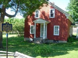
- Wilder Homestead, near Malone – boyhood home of Almanzo Wilder.
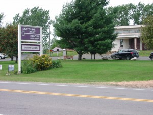
- Akwesasne Cultural Center, Museum and Library, Hogansburg – The collection includes over 2,000 photographic objects and over 700 ethnographic objects of various kinds, related to the Mohawk community of Akwesasne.
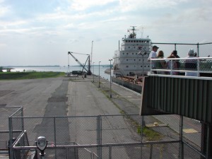
- Watch the ships move through the Eisenhower Lock, Massena – the observation deck over the lock provides great viewing as ships up to 740-feet long pass slowly by; visitor center is open from Memorial Day weekend through Labor Day.
see Adirondack Scenic Byways.org for many more points of interest along this route
Bike Events in the Area
see the complete list of bike events in the region
Bike Shops Nearby
- Frederick’s Bike Shop, Malone
- High Peaks Cyclery, Lake Placid
- Placid Planet Bicycles, Lake Placid
- Maui North, Plattsburgh
- The Wooden Ski & Wheel, Plattsburgh
- Viking Ski Shop, Plattsburgh
also see the complete list of bike shops in the region
Visitor Information
- Adirondack Regional Tourism Council
- Clinton County
- Essex County-Lake Placid
- Franklin County
- Wilmington-Whiteface
- Malone Area Information
also see the complete list of visitor information resources for the region
Check in with Chamber offices, bike shops and other sports shops in the area to get the latest information and review your route with someone knowledgeable of the area. When biking, dress for the weather and carry water, snacks, map, repair kit and cell phone. When biking in rural areas, services could be few and far between, and cell phone service may not always be available. See the Before You Ride notices in the bottom section of this website, as well as the Disclaimer notice.
Below are some of the sights along the way. Scroll over an image to see its title, or click an image to enlarge it and then move through the entire gallery (from the gallery, click on one of the large image to return here).
| Warren County Bikeway | Glens Falls | Lake George Village |


